So, Paula and I spent last weekend up-Island and over on the mainland. We took the train up to Nanaimo so that Paula could attend a conference on Children's Literature at the Van Island University (it used to be Malaspina College, but apparently this name sounds better for a university). I got a day and a half to explore the downtown/Old Quarter of the city: there's been a lot of money spent over the last decade to restore and reclaim the downtown and it was interesting to see the results.
The shoreline is pretty much parks and marinas and is doing quite well; there are lots of expensive boats and they are being serviced by both the old (the old Nanaimo shipyard is still there and still going) and the new (there's a new boatyard that boasts a 45 tonne hoist that picks your boat up and deposits it in a marked parking stall in the parking lot, where it is then worked on—strange to look at first, as it's all angle parking and way too open and clean to be a proper boatyard, but clearly a huge investment of $$$$$$ that someone expects to pay off). The city has been smart enough to put in a decent walkway down the length of the shore, making it not only accessible, but an enjoyable walk as well. Very smart. And they are (imagine a shocked look on my face...) maintaining the walkway as well! It was clean, well marked, and had a minimum of graffiti and garbage.
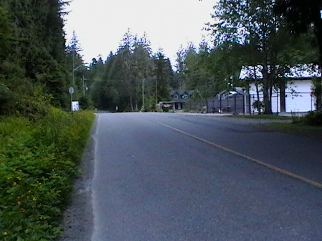
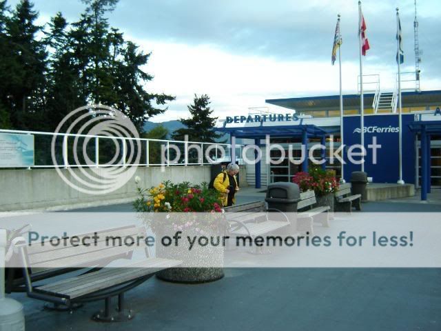
The original downtown area, now bypassed by the highway instead of being the target, was obviously suffering. There are a lot of old buildings in the area, but buildings they decided to restore rather than destroy. Hard to think of an equivalent in Edmonton with the exception of Strathcona. Anyway, lots of windy streets, old “vernacular” architecture (means old building styles brought to a new place and modified to suit—think Newfoundland), but no longer any reason for any of them to exist. Except, of course, that they feel better than new designs, they are more human sized, and people just like them better than the corporate glass boxes we're surrounded with these days. Little touches like cornices or brick-framed windows, three or four stories maximum height (because that's all that people are really willing or able to walk up), smaller footprints and quirky styles make these buildings people scaled and people friendly.
So a lot of money was again spent on fixing things up, cleaning up the streets, repairing potholes, upgrading the buildings (painting them....), and just generally doing a decent urban renewal project. Then they made it possible for great little stores to move in—no chains, all local—put up a lot of signage, encouraged restaurants and coffee shops, built a theatre, expanded the library and art gallery, and sat back to await the revitalization of the area.
And are still waiting. It's kinda worked—the shops look great, but there are a number of empty storefronts. Tourists have somewhere to go (witness me...), but an appreciable percentage of the population are still the unwaged and homeless. The mall on the edge of the Old Quarter has numerous empty shops and the “big” department store anchoring it is a Fields (to be fair, they do have a London Drugs as well) and they majority of the people in the food court seemed to be the dazed and confused, rather than the hip young urbanites that were supposed to be attracted to the area.
So what went right with the harbour and wrong with the downtown? Why the difference? Admittedly I was only there a day and a half and didn't really talk to anyone about it, but it seems fairly clear to me. The harbour has no choice—it has to be on the water. Whoever was in charge of the redevelopment recognized that, and didn't allow the waterfront to be completely given over to the blight of high-rise condos (although there is one that's going up—twenty stories or so—that's stealing light and views from a big chunk of its neighbours). By upgrading services like power and water etc. to the harbour and stabilizing its future (no condos), the marine industry was quite willing to do its own upgrades. Knowing that the harbour was going to remain a harbour left money confident enough to invest in the area for what it was—not as an investment into what they might be able to turn it into (condos again. Low to moderate risk, high rate of return—high social and public cost, but that can be fobbed off on anyone but the investors). So a stable environment, the lack of options for relocation (can't exactly move a harbour when the land prices rise too high), and upgraded services to support the industry meant that investors with a good business plan would see a fair return over the long term. As long as the zoning allows only marine-based services in, the market could be trusted to develop a vibrant waterfront.
Why doesn't it seem to have worked in the downtown/Old Quarter? There's a not-awful mix of residential and commercial zoning. The city worked on the service upgrade (upgrading and repairing the public side of things like sidewalks and roads, developing signage, advertising, and imposing some consistency on the area), and clearly modified the taxation and development rules to encourage the restoration and repair of the various buildings. So why the mediocre response?
I think it's because its not a harbour. The city has continued to expand—indeed, encouraged expansion—and allowed the kind of awful commercial development we've seen everywhere in North America over the last fifty years. Larger and larger chain stores, bigger and bigger parking lots, and continued movement into suburban development with its reliance on the car and all that that has implied. You can't restore life to the downtown core while sucking the life out of the city and spreading it out through suburban development. After all, it's called sub-urban for a reason. It is less urban and less than urban development. I'm not yelling about the public and private encouragement for individual home ownership (although that lead to the sub-prime mortgage crisis), I'm just saying that suburban sprawl leads to problems, and the reliance on the car as the primary for of transportation multiplies those problems a thousand-fold.
The trip up and back on the train was really quite nice. The roadbed has been unmaintained for decades, so the train's speed is restricted and it rocks and rolls a lot, so the trip takes about 2½ hours—a good hour longer than it needs to. On the other hand, it is still very small-town: if you're waiting to get picked up at one of the smaller stops, you wait until you see the train coming and then flag it down. Getting on and off is really relaxed—as is the schedule. Late is not a big deal; if you can't afford 15 minutes, don't ride the train. The cars are old, but clean. The lock on the bathroom door is a cotter pin shoved into a hole in the latch to block the handle's movement. There's no services (no coffee or snacks, for instance), but there's also no stress. Exactly my speed. Now if I could only take my bicycle with me, it would be perfect.
After Nanaimo, we took the ferry to Horseshoe Bay at the north end of Vancouver, and then another ferry to Langdale where we were met by friends and driven the 4 km to Gibson's Landing. Donna and Clint were celebrating their birthdays, and we attended day two of the party (okay, it was a brunch, but still part of it all).
Gibson's is where The Beachcombers was filmed for 16 years, and we had brunch at Molly's Reach, the restaurant at the middle of the show. Next to it was Bruno Gerussi's boat from the show, the Persephone, mounted and on display. It was Kind of strange to be looking at the actual Molly's Reach and the Persephone was a lot smaller than I had thought it would be. Was it cheesy? You bet, but it was good Canadian cheddar! Really interesting to visit a place that was pretty much a myth from my childhood. Maybe the Beachcombers is why I felt so at home when I got to the coast....
We did some hiking on one of the smaller islands (Keats Island) which meant taking a water taxi across the strait. Tony, the operator, was a lot of fun, pointing out local landmarks, discussing local history, and generally being a bit of a character.
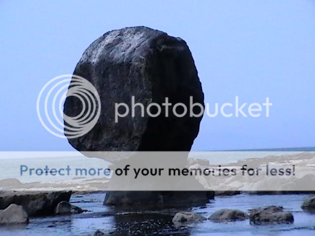
Tony dropped us on Keats, which is mostly privately owned, with a couple of small areas marked off as provincial parks. We, Paula and I and another couple we've met before, Katie and Joseph, hiked a couple of miles around one end of the island, exploring a mini-beach and clambering over rocks to get to viewpoints. You know, all the basic things you do when exploring a new area.
The island has kept track of its own development, having its own water system in place and a summer bible camp providing a focus. The roads are mostly goat trails, with a few places set up for car traffic (??? it would take less than two hours to walk the perimeter of the island, so I don't get the need for cars. Even one of those four wheel ATVs would be understandable—although horribly noisy, polluting, and unattractive). There were dozens of sailboats—all parked in yards 15 to 25 metres above the ocean for the winter.
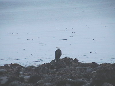
After we walked around the one end of the island, we came back to the dock and then walked across the island, following Tony's instructions. We found a really nice bay, all fissured and water-worn rock with no beach. The bay was filled with surf scoters, little black duck-like birds that we'd seen flying along just above the surface of the ocean while we climbed the end of the island. Here, they were clustered in a group on the water, stretching out in a long curved line from near-shore to beyond the headlands at the entrance to the bay. We had a half-hour or so to kill, so we sat in the sun and just watched the action on the water.
We couldn't really figure out what the birds were doing; they just swam about in smaller groups in this long line. The curve seemed to be following something, but it was nothing we could see or even guess at. We chatted away, relaxing, until someone noticed that the scoters were starting to dive. Not all of them, just some of them in the middle of the line. And they didn't all dive at once, but more like an Esther Williams / Busby Berkley musical, they dove in small lines, maybe 10 at a time, sequentially. Like the girls going off the edge of the pool at the beginning of a production number in a movie. One group, bloop. Next group, bloop. Next group, bloop. Until 40 or 50 birds had dove under water.
Now, normally its hard to see the little buggers come back up. They dive, they swim after stuff—or try to escape from the threat they perceive from you—and they come up far from where they started in unexpected directions. This time it was different. This time the first couple of birds came up not far from where they started. Then some more in the middle of them. And unless you watched very closely, you wouldn't see the birds resurfacing. Instead, the group seemed to magically expand over a short period. The scoters that surfaced later tended to come up in the middle of the ones that had already come up. So the early birds masked the return of the later ones, making it look like the density of the birds was magically increasing.
What were they doing? Still don't know for sure, but back at the dock in Gibson's, there were people fishing under the wharf for “shiners”, small fish that are suitable for bait for bigger fish. I think the scoters were feeding off a large school of something similar (probably herring, as there were people fishing them off bridges in Victoria the last couple of weeks). The big curve the birds were floating in seemed to be the edge of an eddy line, where two currents were meeting as the tide moved the water past the bay. It ended up being a fascinating half-hour bird watching.
The trip back was pretty much the same as the trip there, only in reverse. Clint accompanied us back to Horseshoe Bay and then it was another ferry ride , a quick connection to the train, and back to Victoria. We walked a couple of blocks and took a bus home.
The secret? Pack light--we took our Acer Aspires and a few clothes. And extra money. That way if we really needed anything, no worries. There were stores everywhere we went. And without stuff to worry about, we could concentrate on enjoying the trip and the people. And added only minimally to our carbon footprint.
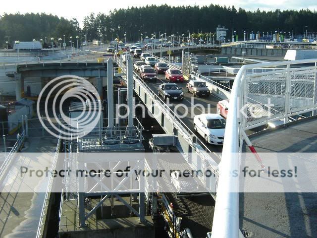 Notice that there's two layers of traffic loading. That's a lot of cars, and this isn't one of the new "Super-C's."
 Passengers, on the other hand, have a much quieter boarding experience.
 Although there are a lot more passengers than 20 years ago. Paula and I have boarded, gone up a deck, found kiosks to sit at (so that I could plug in the Aspire 1ne), and dropped our packs, and there are still walk-ons loading.
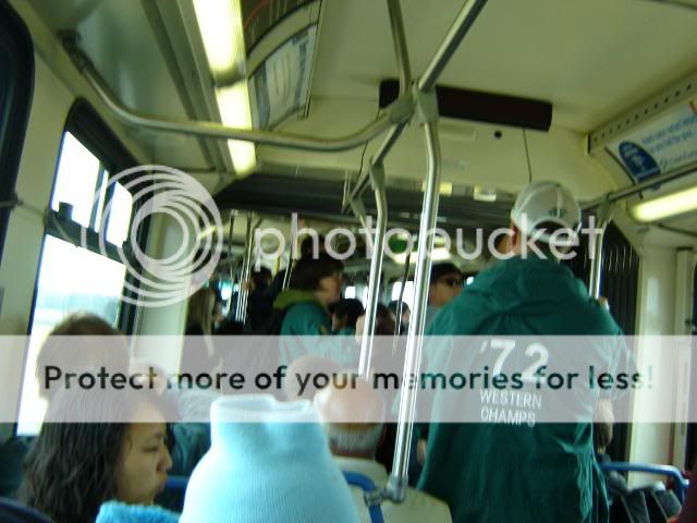 This was one of the articulated buses we're familiar with from our days in Edmonton, but haven't ridden out here. Victoria went with the even cooler, retro-styled double deckers rather than the articulated buses. A good choice, I think.
 And after decades:
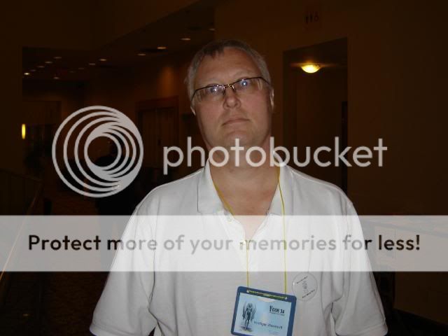 Garth! It was great to see Garth again and catch up on at least an overview of the last few years.
 like Karl, busy minding the Neo-Opsis table.
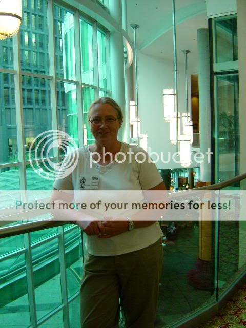 And Stephanie, gettinga few minutes away from the table.

 Which was neat and well-attended. The idea was to create various circles of chairs and then scatter author names about, so that people could either sit beside authors they knew, or figure out who it was they were sitting beside.
 There was also a book table--these are, after all, authors.
 Brian Hades
 Barry Alder
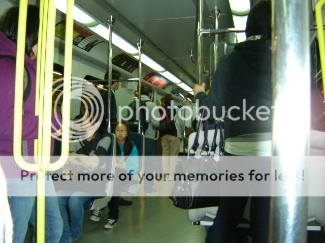
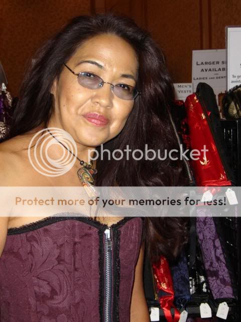
 Selu--whom we had met on the Skytrain, having completely missed her on the ferry and bus....
 Paula, having a good time chatting.
 And Fran. Overall, quite a different Friday for me.